About King George
The History
of King George County
King George boasts rich historical connections to Native American tribes, early European settlements, the American Revolution, Civil War and more. The area was home to the Rappahannock and Patawomeck tribes—which continue to be active in the community—and is also the birthplace of James Madison, the fourth president of the United States who wrote the nation’s constitution and Bill of Rights. King George played a pivotal role in many historical moments that tell the story of state and nation’s important heritage.
Indigenous Peoples & European Exploration
King George is one of five counties on the Northern Neck, the northernmost peninsula on Virginia’s coast. The region has been populated since the Neolithic period, with evidence indicating settlement around 8000 BCE or earlier. By the 16th and 17th centuries, the Northern Neck was populated by the Rappahannock, Patawomeck, Moraughtacund, Manahoac, and Pissaseck American Indian tribes alongside several smaller affiliated groups. All major tribes were part of the Powhatan Confederacy, a centralized alliance among Eastern Virginia tribes headquartered in modern-day Gloucester. Indigenous peoples in the Northern Neck hunted, fished, gathered, and cultivated crops such as maize, squash, and beans. They lived nomadically and seasonally, moving whenever an area’s resources had been depleted. Tribes in this region were matrilineal, meaning that heritage and property were passed through the mother’s side. Women played an equal and arguably dominant role in society, as they were responsible for constructing homes out of saplings and reed mats, butchering game, preparing food, sewing clothing, and tending crops.
Despite thousands of years of Indigenous presence, the Northern Neck was claimed by King James I of England when the Virginia Company of London established Jamestown in 1607. Captain John Smith is the first known European to have visited the Northern Neck, doing so first as a prisoner of the Powhatans and later during an independent exploration. He passed through present-day King George County at the village of Nantaughtacund, which was the largest of five major Indigenous settlements on the Rappahannock River recorded by the Europeans in the 17th century. Evidence suggests Nantaughtacund has been inhabited since prehistoric times, and its remains are currently protected within King George’s Nanzatico Archaeological Site. Upon passing through this area, Smith wrote of the peninsula, “Heaven and earth never agreed better to frame a place for man’s habitation; were it fully matured and inhabited by industrious people. Here are mountains, hills, plains, valleys, rivers, and brooks, all running most pleasantly into a fair Baye, compassed but for the mouth, fruitful and delightsome land.”
The relationship between the English and the Powhatan Confederacy alternated between war and peace for decades. A temporary period of peace was achieved after Pocahontas married Englishman John Rolfe, but even the circumstances under which this was achieved started with violence. According to Patawomeck and Mattaponi oral tradition, Pocahontas was living in the Patawomeck village of Passapatanzy in 1613, located in present-day King George County. She was married to Kocoum, the brother of a prominent Patawomeck leader named Iopassus. At the time, Pocahontas was about 17-18 years and had a baby daughter. An English captain, Samuel Argall, conspired with Iopassus to kidnap Pocahontas and ransom her to her father, the Powhatan chief, in return for an alliance. Kocoum was killed by the English during the kidnapping and Pocahontas was sent to Henricus, an English settlement in modern Chesterfield County, where she was baptized and married to John Rolfe. Their daughter was raised by the Patawomecks in Passapatanzy after the loss of both parents.
Several peace treaties were signed and over the years as European settlers slowly encroached on Indigenous territory. The power of the Powhatan Confederacy was eroded as tribes began to flee the area and tribe members were killed in raids and skirmishes. In 1646, a treaty between the Powhatans and the English was signed that disbanded the Confederacy permanently. According to the terms, Eastern Virginia was split between the English colonists and the American Indian tribes. The Northern Neck was retained for Indigenous use and no Europeans were allowed inside the territory. However, this agreement came to an end only three years later when renegotiations allowed Europeans to settle in the region. Over the next several decades, migrants began to slowly push the remaining tribes out of the Northern Neck. In 1704, the Nanzatico people submitted a complaint to the Virginia General Assembly that European settlers were encroaching on their traditional territory in what is now King George. The Assembly never acted, and the Nanzatico retaliated by killing an English settler family, the Rowleys. A militia raided the Nanzatico village and captured around fifty people. The perpetrators of the Rowley murders were tried and executed. All captured Nanzaticos over the age of twelve were sold into slavery, while the remaining children were forced to work as servants for Virginia colonists. This incident marked the end of Indigenous hegemony in the Northern Neck.
The Colonies & the Revolutionary War
Over the next fifty years, the Virginia General Assembly established Northumberland County, Westmoreland County, Lancaster County, and Richmond County in the Northern Neck. In 1720, residents of the northern reaches of Richmond County petitioned to the General Assembly to form a new municipality, as some had to travel more than 60 miles by foot, horseback, or boat to the county center for court days and meetings. A new county was subsequently split from the northern region of Richmond County and named after King George I, the sovereign ruler of England at the time.
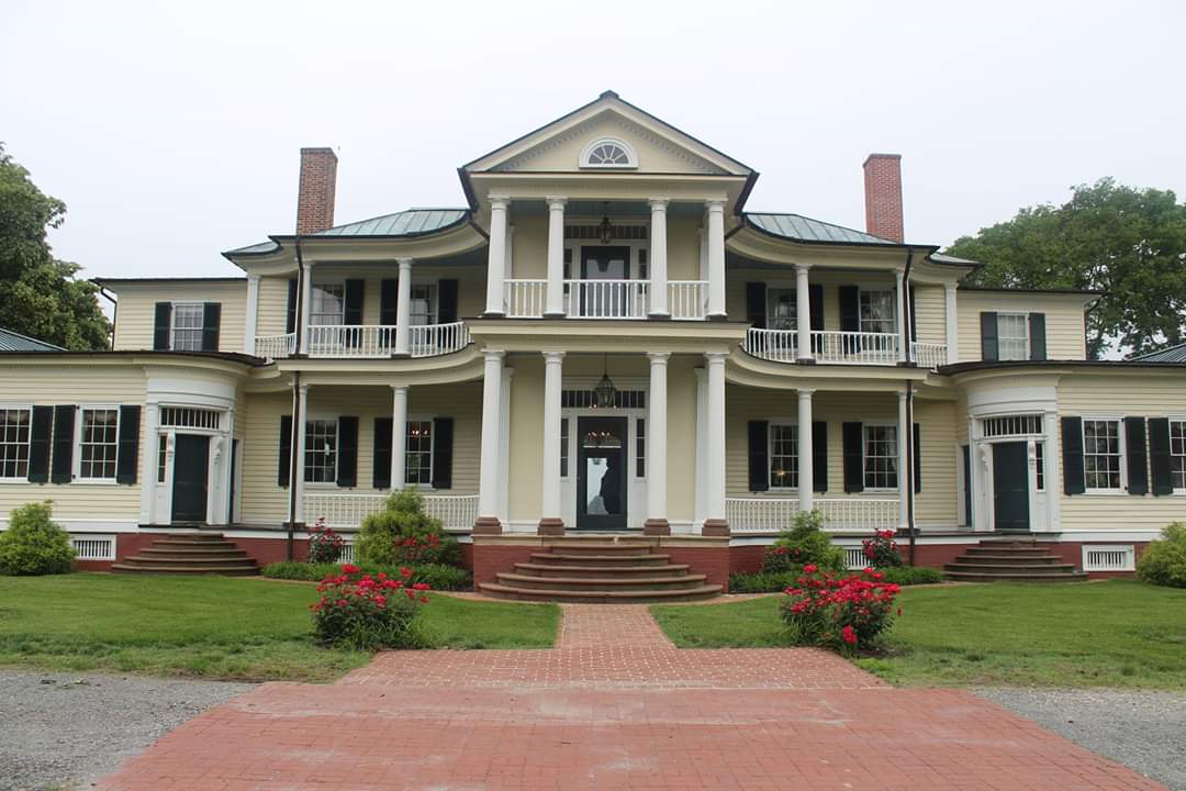
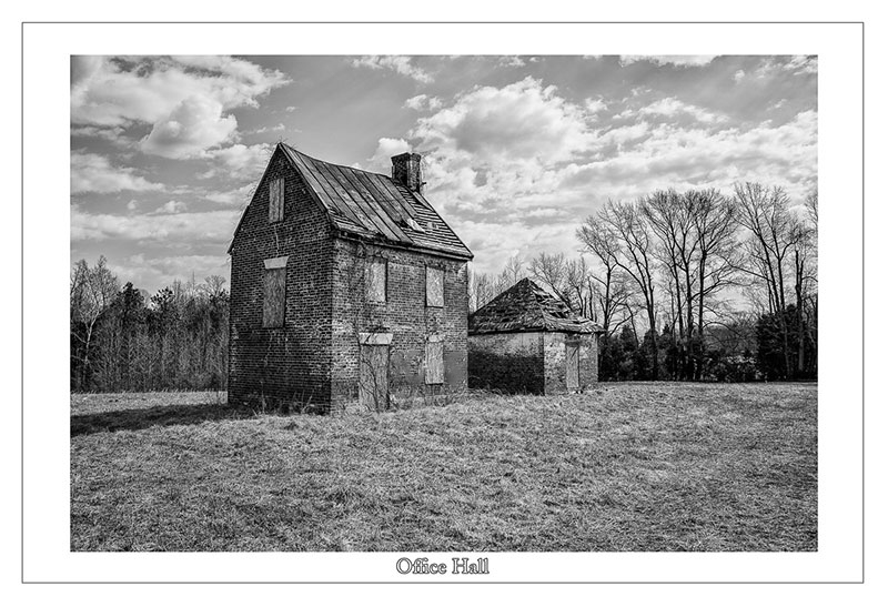
Tobacco plantations flourished in King George County during the 17th and 18th centuries, and the county borders were later adjusted during the Revolutionary War to guarantee access to both the Rappahannock and Potomac Rivers for trade. Wealthy landowners constructed ornately adorned mansions, several of which still stand in King George today. One of these is Marmion, a plantation house reputed to have one of the most richly decorated interiors of any surviving American home from that era. Marmion’s exquisite seven-sided main parlor was sold to the Metropolitan Museum of Art in 1916 and has been on display at the museum in New York City ever since, ensuring a piece of King George is represented at one of the most iconic art institutions in the world. However, this is not the first piece of rare art that King George has been home to – Lamb’s Creek Church possesses one of only three surviving original copies of the Vinegar Bible. This Bible was first printed in 1716 by John Baskett and is reputed to be one of the most exquisite Bibles ever printed in England. However, it is full of glaring spelling errors and earns its name from “Parable of the Vineyard” being misspelled to “Parable of the Vinegar”. King George’s Vinegar Bible is on display at the annual “Lamb’s Creek Sunday” service.
King George became the birthplace and childhood haunt of two influential figures in early America. James Madison was born at Belle Grove Plantation in Port Conway, an area of King George that is named for his mother’s family. He lived at Belle Grove for the first decade of his life before moving to Montpelier in Orange County. Madison went on to play a pivotal role in writing the Constitution and the Bill of Rights and served two terms as the fourth president of the United States. George Washington also had childhood connections to King George – his father’s will was recorded in the county courthouse and the Washington family often attended St. Paul’s Church, which still stands today. Due to its wealth and population by elite families, King George was one of the epicenters of revolutionary thought in Virginia. This was most clearly illustrated by the drafting and signing of the Leedstown Resolutions in 1766. At the time, Leedstown was a port within the borders of King George, and citizens wrote and signed a declaration directly protesting King George III’s Stamp Act. These documents disseminated north and influenced public opinion across the colonies, sowing the seeds of the American Revolution.
However, the prosperity enjoyed by wealthy landowners in King George was built on the labor of enslaved Africans and American Indians. In the Northern Neck, enslaved people were forced to work primarily on tobacco plantations and were subjected to deplorable practices such as family separation, brutal physical punishment, and extreme working conditions. However, soil degradation and erosion caused the decline of the tobacco industry in the Northern Neck during the early 19th century, and many landowners switched to farming other crops. Notably, the number of enslaved individuals in King George far outnumbered the number of free individuals from the colonial era until the Civil War. According to the Virginia Census, there were about 3,600 enslaved individuals and 2,900 free individuals living in King George in 1860, one year before the South seceded from the United States. This means that at the time, more than half of the county’s residents were “owned” by other people and did not have the rights to liberty, education, religious freedom, marriage, assembly, property ownership, political participation, and more.
The Civil War & John Wilkes Booth’s Flight
Though no battles took place in King George during the Civil War, the immediate surrounding Fredericksburg region saw some of the deadliest battles of the war such as Chancellorsville, Wilderness, Fredericksburg, and Spotsylvania Courthouse. Consequently, King George became a major strategic point for both sides of the conflict. In 1861, the Confederates blockaded the Potomac River at Mathias Point in King George. A Union steam engine, the Thomas Freeborn, was sent to disrupt the artillery the Confederates had installed there. Upon being attacked, the Confederates retaliated and mortally wounded Commander James H. Ward, who became the first Union naval officer to be killed in the war. King George continued to be important later in the war as senior Union general Ambrose Burnside used Rokeby, a historic manor in King George, as his headquarters during the Battle of Fredericksburg in 1862. Another notable Civil War figure, William “Extra Billy” Smith, was born and raised in King George. He was the oldest general in the Confederate Army and was the governor of Virginia when the Confederacy dissolved in 1865.
Five days after Robert E. Lee’s surrender at Appomattox, John Wilkes Booth assassinated Abraham Lincoln in DC and evaded Union troops for days, passing directly through King George. Booth and his co-conspirator, David Herold, attempted to cross the Potomac River at night into Virginia nine days into their journey. They wanted to land at Machodoc Creek in King George, where they planned to go to the home of Elizabeth Quesenberry, a Confederate sympathizer who aided secret communications during the war. However, Booth and Herold became lost on the river and spent another day in Maryland before accidentally landing at Gambo Creek in Dahlgren. From there, they had to walk more than a mile through a marsh to Quesenberry’s plantation. Upon request, Quesenberry refused to help them, and Booth and Herold changed courses and traveled to the historic home of Cleydael later that day. The home’s owner, Dr. Richard Stuart, was the wealthiest man in the county at the time and had cared for Lee’s daughters during the war. He offered Booth and Herold food and rest before sending them off with Confederate agents.
That night, Booth and Herold forced the Lucases, a free Black family, out of their home at knifepoint and slept there for the evening. The next day, they hired a man to drive them to the Rappahannock River at Port Conway. There, they crossed the river into Port Royal and out of King George. Booth was apprehended by Union soldiers and killed less than two days later at Garrett’s Farm in neighboring Caroline County. Quesenberry and Stuart were both exonerated of aiding and abetting Booth and Herold during their escape.
World War I & World War II
In 1918, the Naval Surface Warfare Center (NSWC) was established in Dahlgren to test and develop new battleship guns. Dahlgren was chosen because of its geography and remoteness, as the area between Machodoc Creek and the Potomac River is straight with calm water. Currently, NSWC’s Potomac River Test Range is the longest over-water naval gun testing range in the world.
Notable projects developed at NSWC during World War II include the triggering device on the Little Boy atomic bomb, the Norden bombsight used on American bomber aircraft, and early computers. Dahlgren also employed many famous scientists and engineers who were directly or tangentially involved in the Manhattan Project, such as Albert Einstein, Edward Teller, Norris Bradbury, Grace Hopper, Carl Norden, Howard Aiken, and Deak Parsons.
Since then, Dahlgren has been at the forefront of naval advancements such as the Tomahawk missile, the Aegis combat system, and the CRBN defense protocols, and has created at least two new categories of naval vessel. The Dahlgren Heritage Museum was opened in 2013 in King George to celebrate the rich history of Dahlgren and conduct on-base bus tours.
Civil Rights Movement
In 1946, several Black students and their families filed a lawsuit (Civil Action No. 631) against the King George County School Board for violating the “separate but equal” doctrine used during segregation. The district court found that the educational facilities and equipment offered to African American students were substantially inferior to the ones at the white-only schools in King George. As a result, the county constructed Ralph Bunche High School in 1949 for African American students.
When Brown v. Board of Education officially ended school segregation in 1954, municipalities across the South were slow to integrate, especially due to a lack of deadline stipulation – in his opinion, Justice Warren wrote that schools should integrate simply “with all deliberate speed”. King George did not integrate its schools for almost a decade, until thirty-eight African American students and their families filed a second lawsuit (Civil Action No. 3579) in 1962. The court found that the continued school segregation was not acceptable under the Brown v. Board ruling and ordered the School Board to make and execute a plan for integration.
Though it took several more years, King George High School was constructed in 1968 and opened as a unified school. Ralph Bunche High School was closed the same year but continues to be maintained by its alumni association. It was registered to the National Register of Historic Places in 1998 by the King George County School Board.
1970s – Today
After first being depicted on a float at the King George Fall Festival in 1964, the county officially adopted the Royal Shield of King George I as the official county seal in 1974. The shield is divided into quadrants and depicts the Arms of England, the Arms of Ireland, the Arms of Scotland, the Arms of France, and the Arms of the Electorate of Hanover and the Crown of Charlemagne. The seal is intended to recognize the foundations of the United States that can be found in Europe.
Caledon State Park was established in 1974 as a protected area for bald eagles, wetlands, an old growth tulip poplar forest, and other natural resources that have attracted people to King George for hundreds of years. The land that makes up the park was originally Caledon Plantation, which was established in 1659 by the family that founded the city of Alexandria, VA. The state park has recently begun efforts to identify the enslaved people who lived on Caledon Plantation in order to recognize them and preserve their lived history.
Gladys West is a mathematician and computer scientist who was inducted into the Air Force Hall of Fame in 2018 for her contributions to the creation of GPS technology. When she began her forty-two-year career at Dahlgren, she was one of only two Black women who worked at the NSWC. She was the project manager for Seasat, which was the first satellite that could remotely sense oceans and their movements. After this project, West spent the 1970s and 1980s creating a precise system for calculating the shape of the Earth, which was a cornerstone of GPS development. West retired in 1998 and currently resides in King George.
Jermon Bushrod, a King George native, was selected by the New Orleans Saints as a fourth-round pick in the 2007 NFL Draft. Prior to this, he graduated from King George High School and played college football at Towson University for four years. In 2009, Bushrod was a starter at the Super Bowl and helped the Saints win their first and only NFL championship. He continued to play for the Chicago Bears and the Miami Dolphins before retiring from the NFL in 2019. Bushrod established the Visualize and Rize Foundation in 2010, which supports youth athletic programs and education in Florida, Illinois, Louisiana, and the Fredericksburg region of Virginia. He is continuously involved in the renovation and preservation of Ralph Bunche High School in King George.
In 2023, the grave of a formerly enslaved woman was discovered during the construction of the Oakwood Estates neighborhood in King George. Her name was Anarcha Westcott, and recent discoveries about her life have highlighted her significant contributions to modern women’s health. Author J.C. Hallman has conducted extensive research on Anarcha, and his 2023 book Say Anarcha details her life as an enslaved person and the unethical and nonconsensual gynecological operations that were performed on her at least 30 times before her death in 1870. It is unknown how she came to rest in King George, but she died emancipated and is buried next to her husband and two of her children.
King George County opened the Native American Heritage Trail in June 2024 to recognize the land from the perspective of the American Indian tribes who originally resided there. It includes a geocaching puzzle and seven educational signs at historic sites across the county.


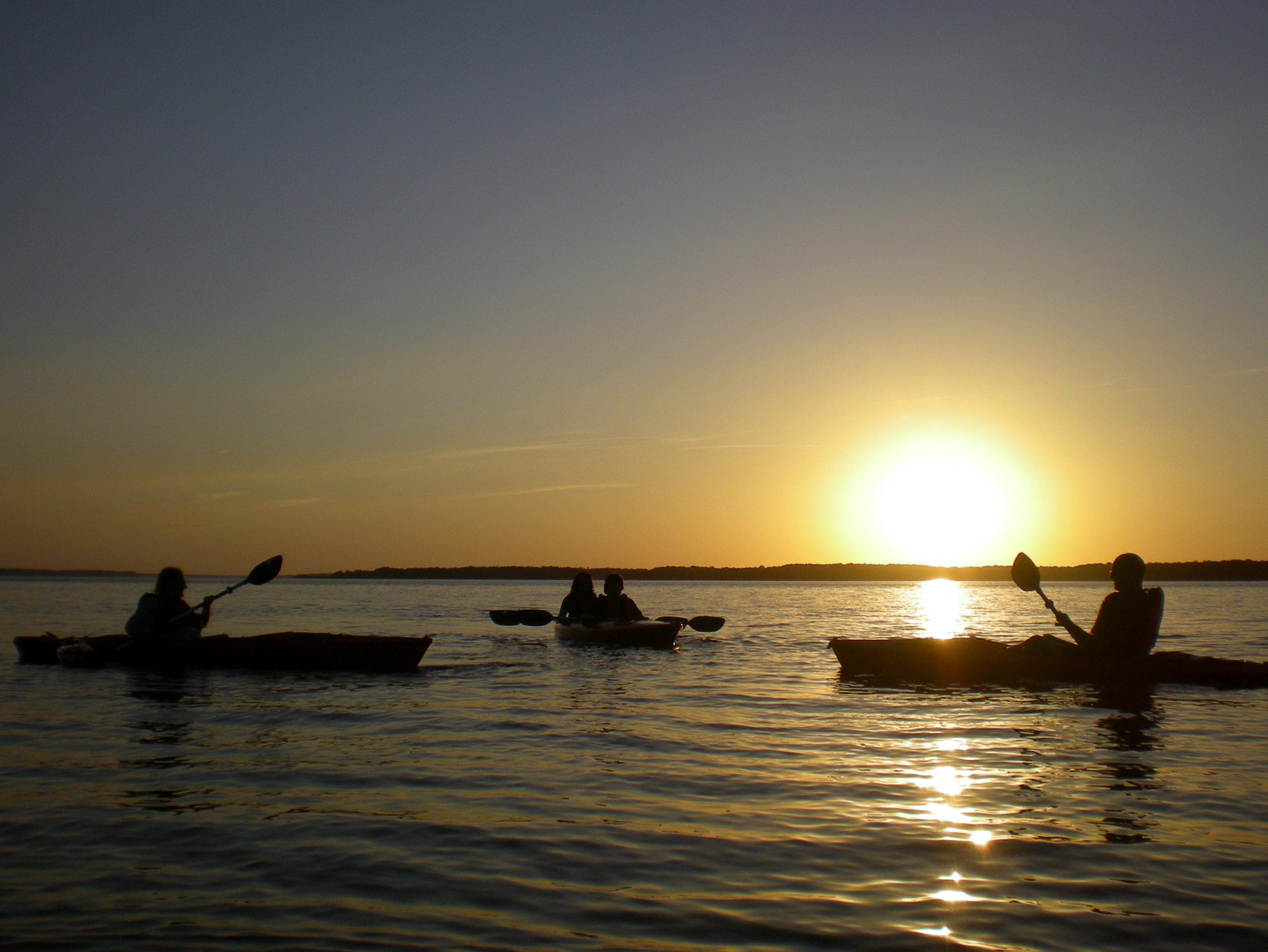
Bask in the History
Explore the rich history and captivating stories behind the historic landmarks of King George County as you embark on a journey through its past.
Find more in King George.
Uncover the excitement of your next adventure in King George, Virginia by exploring a variety of attractions tailored just for you.
Choose a category below to find local destinations.